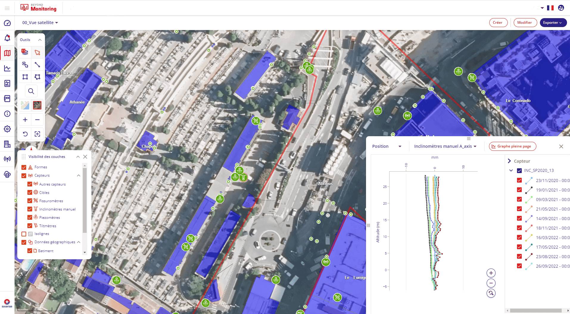
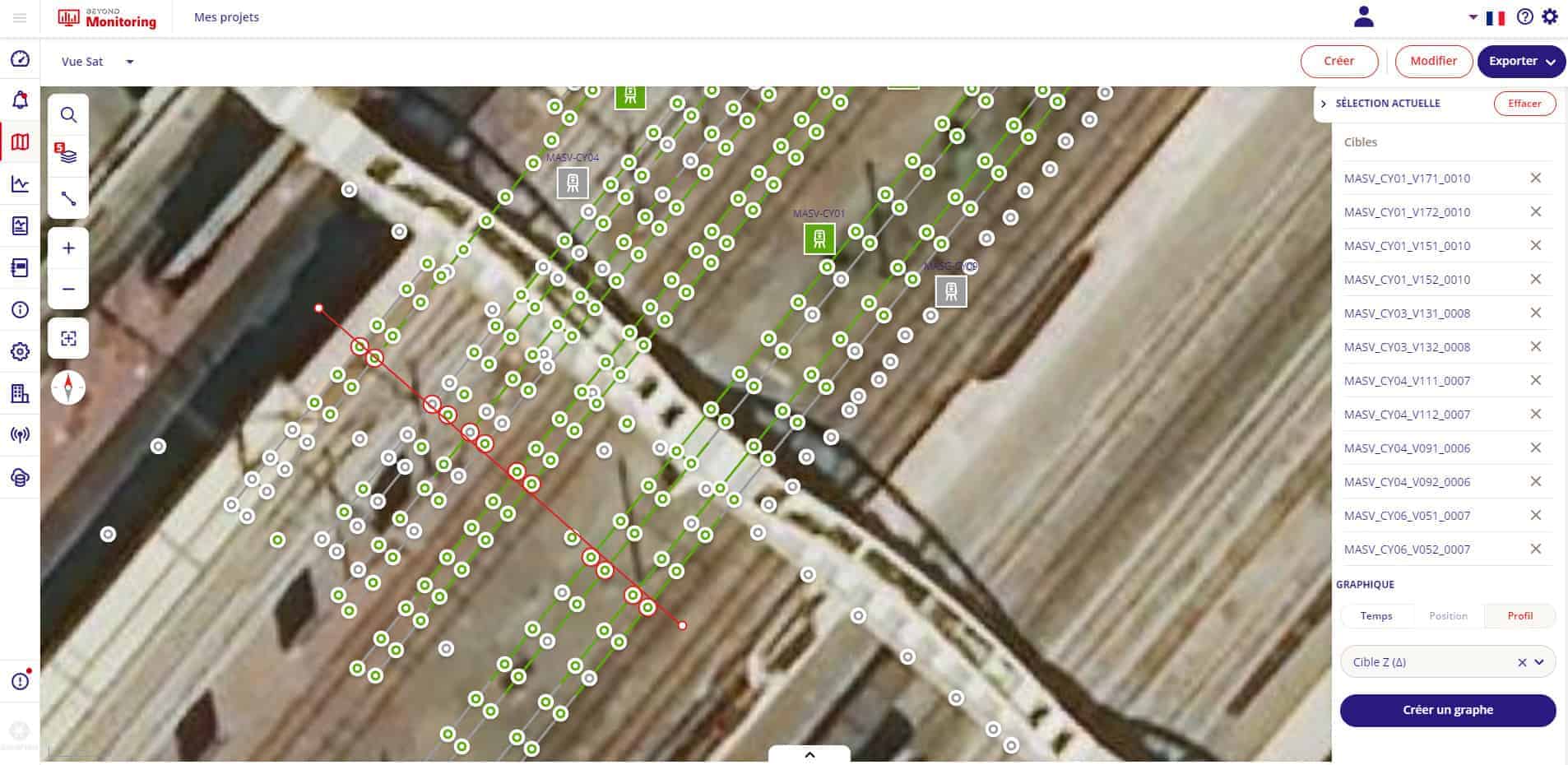
Beyond Monitoring is a software tool that allows real-time management of data from your sites and the surrounding environment. At Sixense, we’ve used our 25 years of experience in monitoring software development with our flagship product, Geoscope, to create a ground-breaking platform.
It is a decision-making tool that enables users to anticipate and manage geotechnical, environmental, and structural risks. Beyond Monitoring enables the integration of all data types derived from various sources and in several formats, including data provided by third-party services with reinforced cyber security as a priority.
Real-time data management of your monitoring sites and surroundings
Beyond Monitoring is the information hub of every project we manage.
Its data management is tailored to suit our clients’ sector-specific requirements, with enhanced performance. Beyond Monitoring is versatile and can be used for small projects with a few sensors and larger, more complex projects with thousands of sensors.
The platform is particularly well-suited for projects where different types of data are being consolidated for analysis.
Regardless of the size of your organization or sites, Beyond Monitoring is a scalable solution that will follow the expansion of your sites and operations.
All data is processed to deliver reliable alarm(s) and ready-to-use information.
<<< Watch our video Beyond Monitoring
Main features
- Real-time data processing
Beyond Monitoring processes real-time monitoring data using a powerful and versatile data-reduction engine. Integrating any type of data (automatic sensors, manual readings, environmental instrumentation, total stations, etc.), Beyond Monitoring provides advanced data analysis and vizualisation for simple or complex structures.
- Dynamic integration of information from third parties
With the possibility to integrate data regardless of the source or the format, Beyond Monitoring can manage data from existing monitoring systems deployed by third parties in a single source of truth: construction site progression, documents, and photos.
- Far-reaching cross-data alarm management
Advanced automatic alarm systems can be configured, allowing real-time alarms for a close follow-up of your project’s critical parameters. From Sixense’s experience, smart alarms allow systems to be solely focused on truly important events and reduces sending less useful alerts. - All sensors, and all data, in one place
Beyond Monitoring supports all geotechnical, structural, hydrological, and environmental sensors, through any logging system, IoT, wireless loggers, cabled loggers, proprietary loggers, and Cloud point data (InSAR, Scanner, etc.) Robotic theodolite and other surveying tools, Machines data, such as Tunnel Boring Machine Data, etc. can be used. - Powerful reporting management system
The Beyond Monitoring reporting module generates periodic reports automatically or manually based on templates or customized reports. In automatic mode, the reports are programmed to be generated and provided, for example at 7h00 AM every morning. - Specific interfaces
Each user has specific information requirements and needs. Common features are made available to all users, while specific interfaces can be configured to each individual’s needs to provide them with the most relevant information. - Animated contour lines and intuitive presentations
Beyond Monitoring provides a clear and user-friendly interface for an easier interpretation of geotechnical and structural events, with the aim of helping engineers understand and analyze their data. Some sites can support hundreds or thousands of sensors, with hourly or daily data transmission, therefore it is important not to overwhelm users with the data. - Cloud, desktop, and mobile solutions
In addition to the classic desktop configuration, the mobile version of Beyond Monitoring ensures your data is readily available at any time & place on your smartphone or tablet. The Beyond Mobile version is an alarm management tool: you receive notifications, view the graph and the life near the point in the alarm, and you can acknowledge the alarm and notify your colleagues, all on the go from your mobile device. - A dedicated Mobile App for manual data readings
The mobile application allows your teams to generate manual readings quickly and safely. The technician follows a tour from one sensor to the next, the manual measurements are then checked and validated on-site automatically, thus avoiding input errors and the need to return to the site later. The measurements are immediately transferred to the database and visible to all stakeholders, without having to wait for the technician to return to the office. The application also works in offline mode. - Embedded dashboard with KPIs
Embedded project dashboards make it easy to track your site’s security and performance of the monitoring system, providing up-to-date information on project KPIs, such as the number of alarms, risk rate of the site, system reliability, sensor quantities, visibility, and measurement accuracy, all in one place. - Web GIS application with enhanced cyber security
As a 100% web-based GIS system, Beyond Monitoring offers a high level of adaptability. It can include any web map service, like the site’s geology, to enhance the views, which helps users better understand the sensor data. Beyond Monitoring is proposed as a Software as a Service (SAAS) hosted in the Cloud.
The platform has several layers of security implemented to guarantee the integrity and confidentiality of all stored, processed, and transferred data.
All data hosted within Beyond Monitoring is encrypted per the HTTPS TL1.3 protocol. In addition, the application is fully protected by two-factor authentication (2FA) sign-in using JWT tokens.
Furthermore, the Beyond Monitoring environment is under the process of ISO27001 certification.
Use cases
Beyond Monitoring is an open data-to-information system for technical risk management in civil engineering for all projects and assets concerned with geotechnical, structural, or environmental risk management.
Application: All projects and assets concerned with geotechnical, structural, or environmental risk management.


